
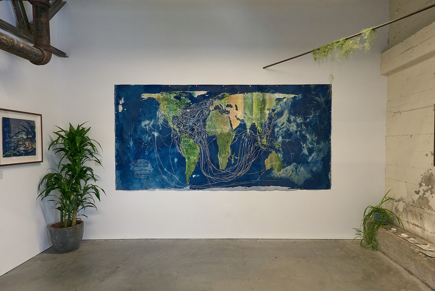
Routes/Roots, 2021. Mixed media on cyanotype and silkscreen print. 10’ x 5’. Made with production support from Brian von Bargen and Jud Bergeron. Photography by Jenna Garrett and the Minnesota Street Project.
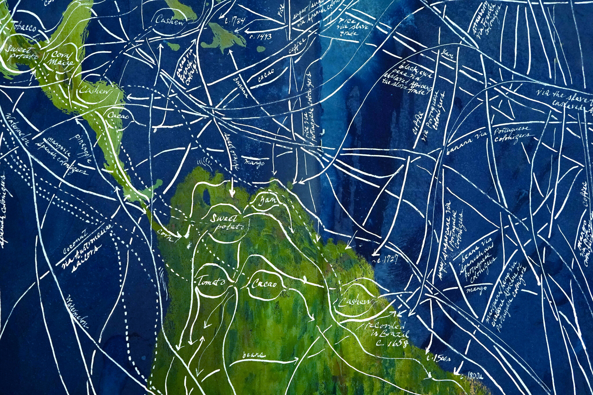
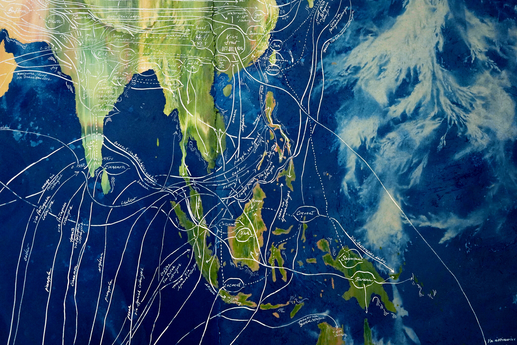
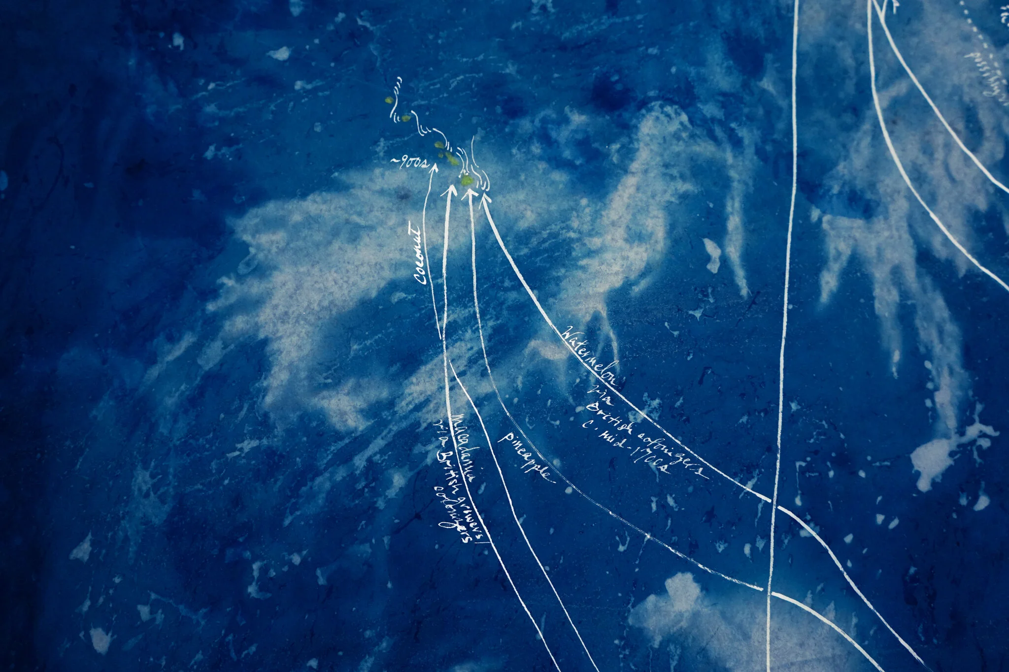
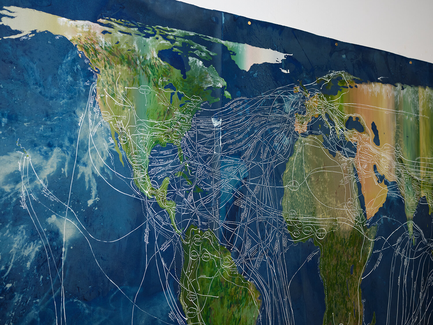
Routes/Roots traces the ways in which major food plants — from peppers to watermelons to coffee — have traversed the world over the past several millennia, along with the human activities that have enabled or necessitated their movement. An incomplete register shaped by the interests and biases of its author, this map nevertheless attempts to record the manifold ways in which colonialism, slavery and capitalistic enterprise have shaped not only what foods we eat and consider ‘native’ to a place, but also how seeds and their fruits can make hostile new landscapes feel like home — or transform fertile soil into unrecognizable fields for industry. When we consider the brutal histories behind many of our favorite foods, what is the true cost of a bag of sugar or a sack of oranges? This work was originally made for inclusion in my solo exhibition new yamfish seed exchange (nyse).
Routes/Roots is scaled according to the Gall-Peters map projection, which maps all areas such that they have the correct sizes relative to one another. Many maps today continue to use the Mercator projection, which was originally used for colonial navigation and incorrectly inflates the size of regions according to their distance from the equator, making regions such as Greenland disproportionately large and continents such as Africa disproportionately small.
Acquired for the David Rumsey Map Center collection at Stanford University. Hi-resolution scan available here.
Details by Connie Zheng; installation documentation by Jenna Garrett and the Minnesota Street Project.